Maps
Cartography drawn for walking
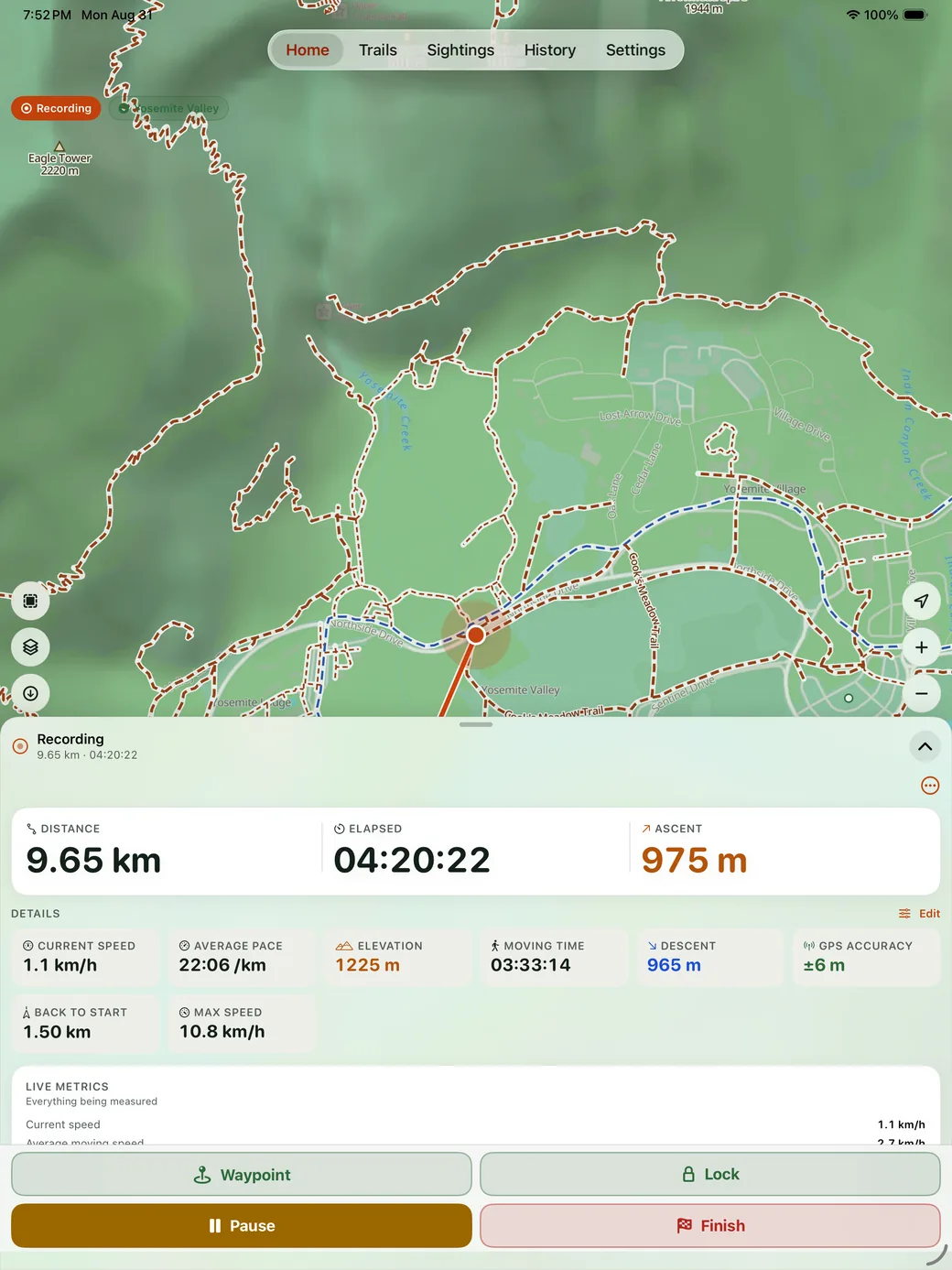
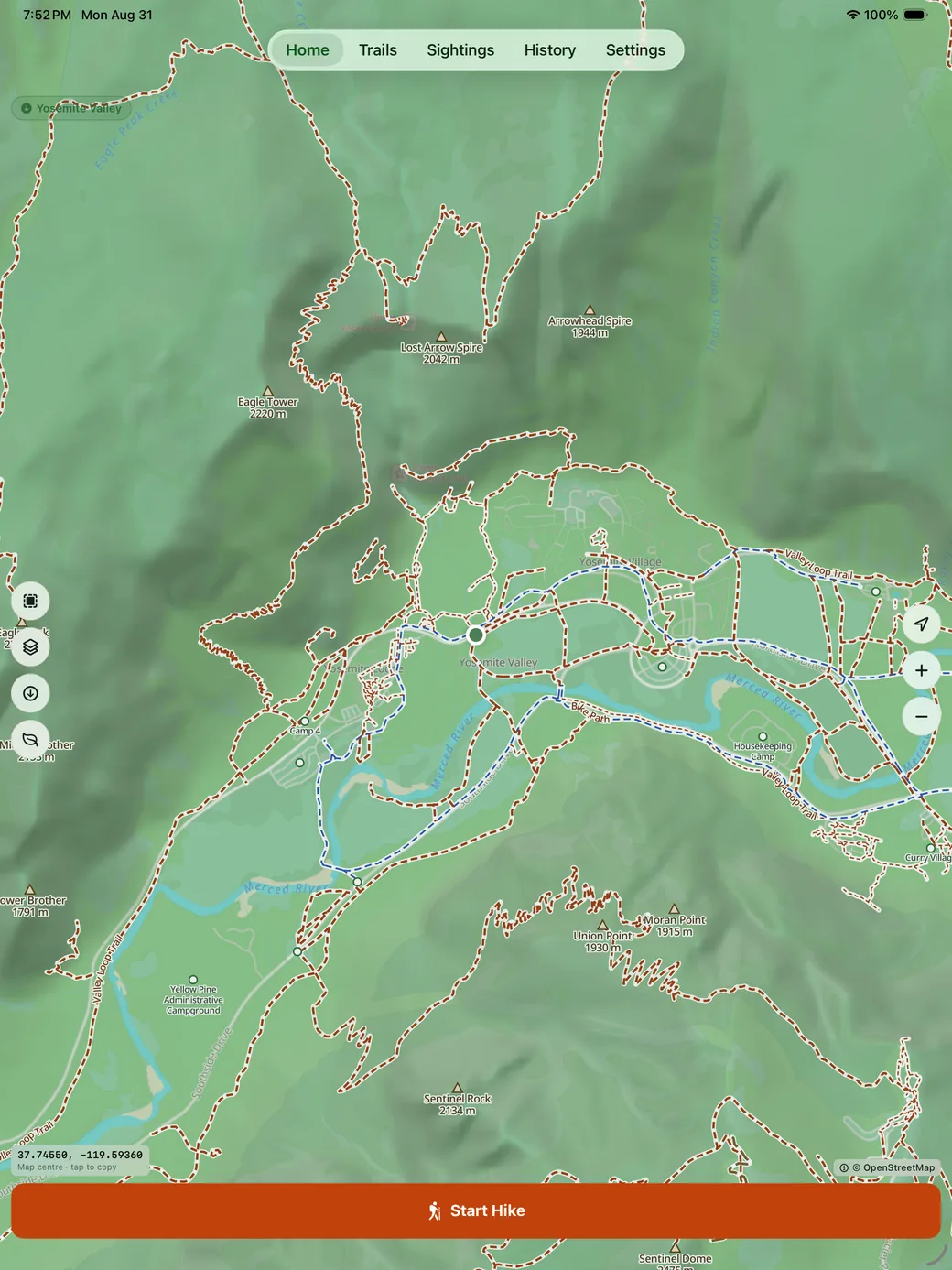
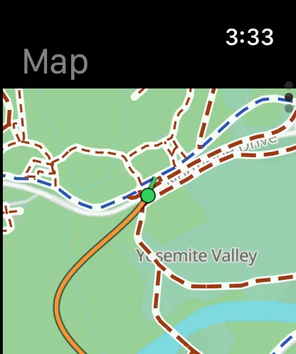
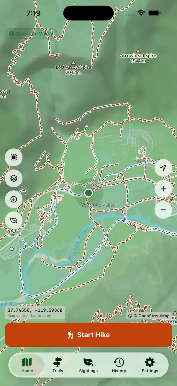
Most map apps draw footpaths as near-invisible hairlines. HikeGPS draws its own hiking cartography over the basemap: trails, tracks, steps and bridleways separated by line style and colour, named along the path, summits labelled by elevation, water and trailheads marked.
Download before you lose signal
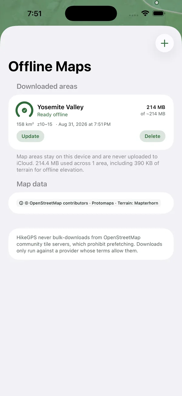
Tap download and the area you are looking at is proposed at once, with its size in megabytes shown before you commit. Downloaded areas render in airplane mode, and the map data stays on your device.
Recording
Recording you will not lose
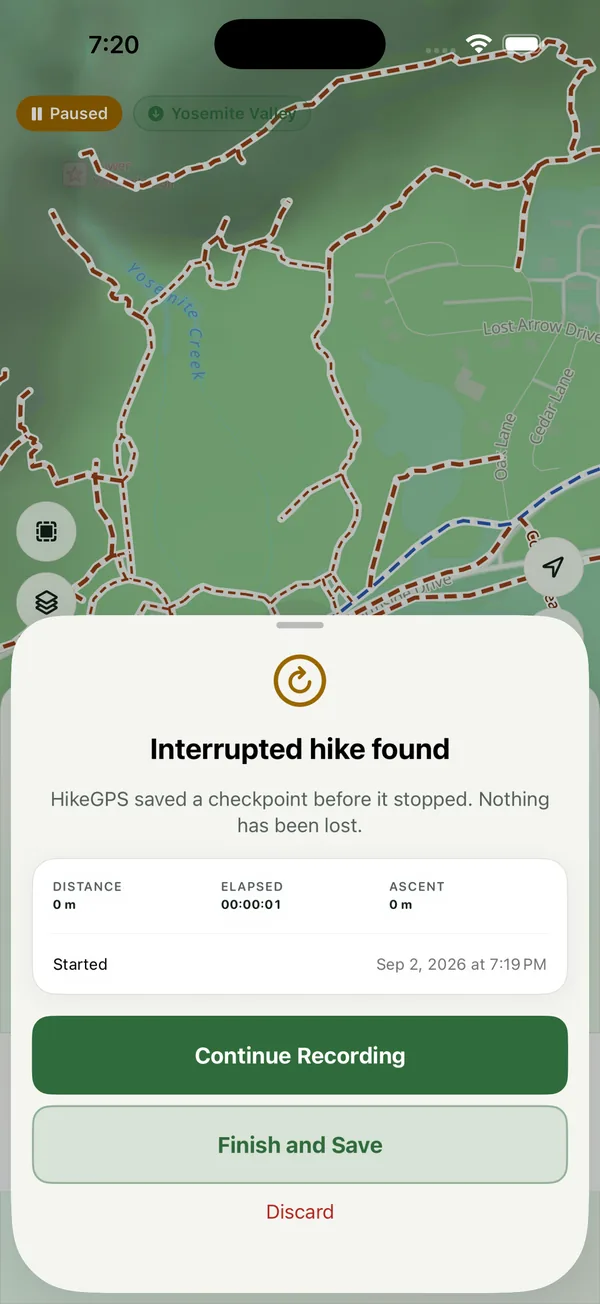
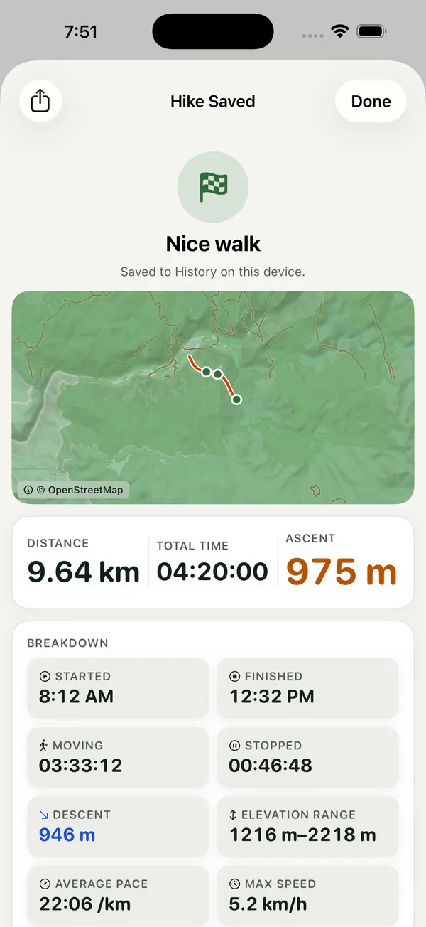
Recording continues with the screen locked and the phone in a pocket. A checkpoint is written continuously, so a crash, a flat battery or a restart does not cost you the hike: it is offered back to you on the next launch. A pause never invents distance or charges the break to moving time, and standing still pauses the clock for you.
Built to be read outdoors
Distance, time and ascent in large tabular figures, over a grid you choose and reorder: pace, moving and stopped time, grade, vertical speed, GPS accuracy, bearing, battery. High-visibility mode thickens strokes for bright sun, and elevation combines GPS with the barometer where there is one, so a wobbly fix is not counted as climbing.
Sightings
Name what you see, without a signal
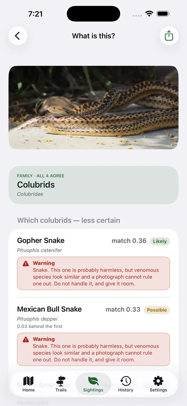
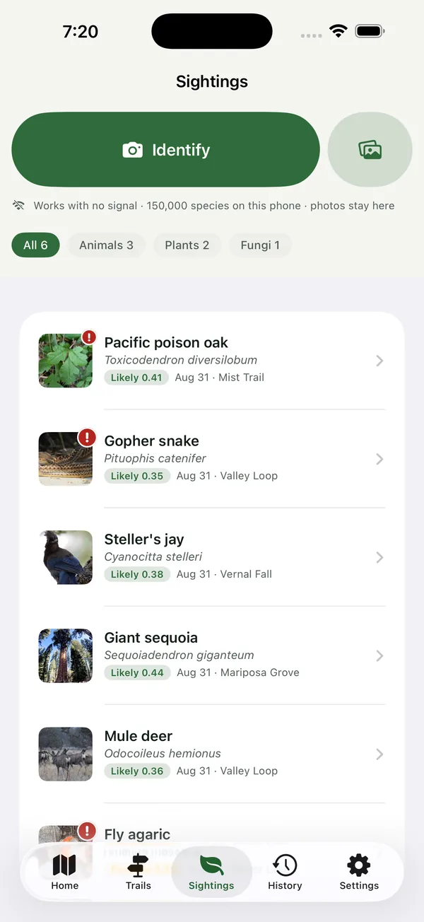
Photograph a plant, bird, insect or fungus and HikeGPS names it on the phone. Nothing is uploaded and no connection is needed: a model covering 150,000 species runs on the device, which is why it works in a canyon.
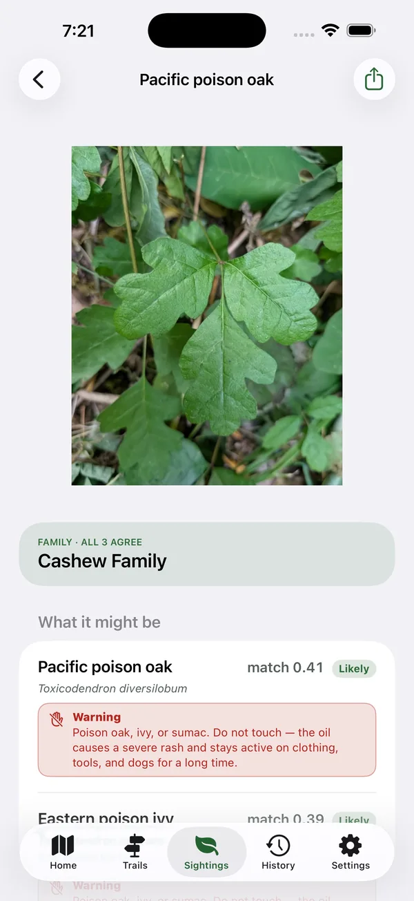
You get several candidates rather than one, and when they all agree on the family or genus it says that first. Identifications are kept in Sightings with where and when they were made, and dangerous species carry a warning sized to the risk, from nettles to rattlesnakes.
- Pacific poison oak Toxicodendron diversilobumLikelymatch 0.00
- Eastern poison ivy Toxicodendron radicansLikelymatch 0.00
- Fragrant sumac Rhus aromaticaPossiblematch 0.00
Species identification is a guess from one photograph. Never eat or touch anything on the strength of it.
Trails and plans
Find a trail nearby, plan ahead
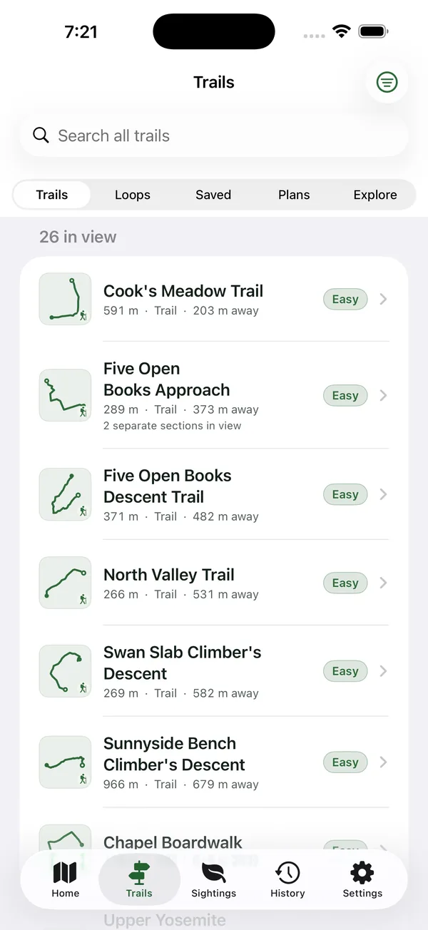
HikeGPS lists every route in view, not only the ones OpenStreetMap has named, with real trails ranked above pavements. Filter by type, length, distance and grade, or search by name. Pick one and it is framed to fit, with an elevation profile and an estimated difficulty that shows its inputs.
Sketch a route by tapping the map or entering coordinates, save it, and follow it later as a dashed guide with no signal. Import or export a GPX track from Files as an editable plan. Tap a labelled point, or press and hold anywhere, and HikeGPS routes to it over the paths already on the device. No routing service, no turn-by-turn, no signal required.
History
After the hike
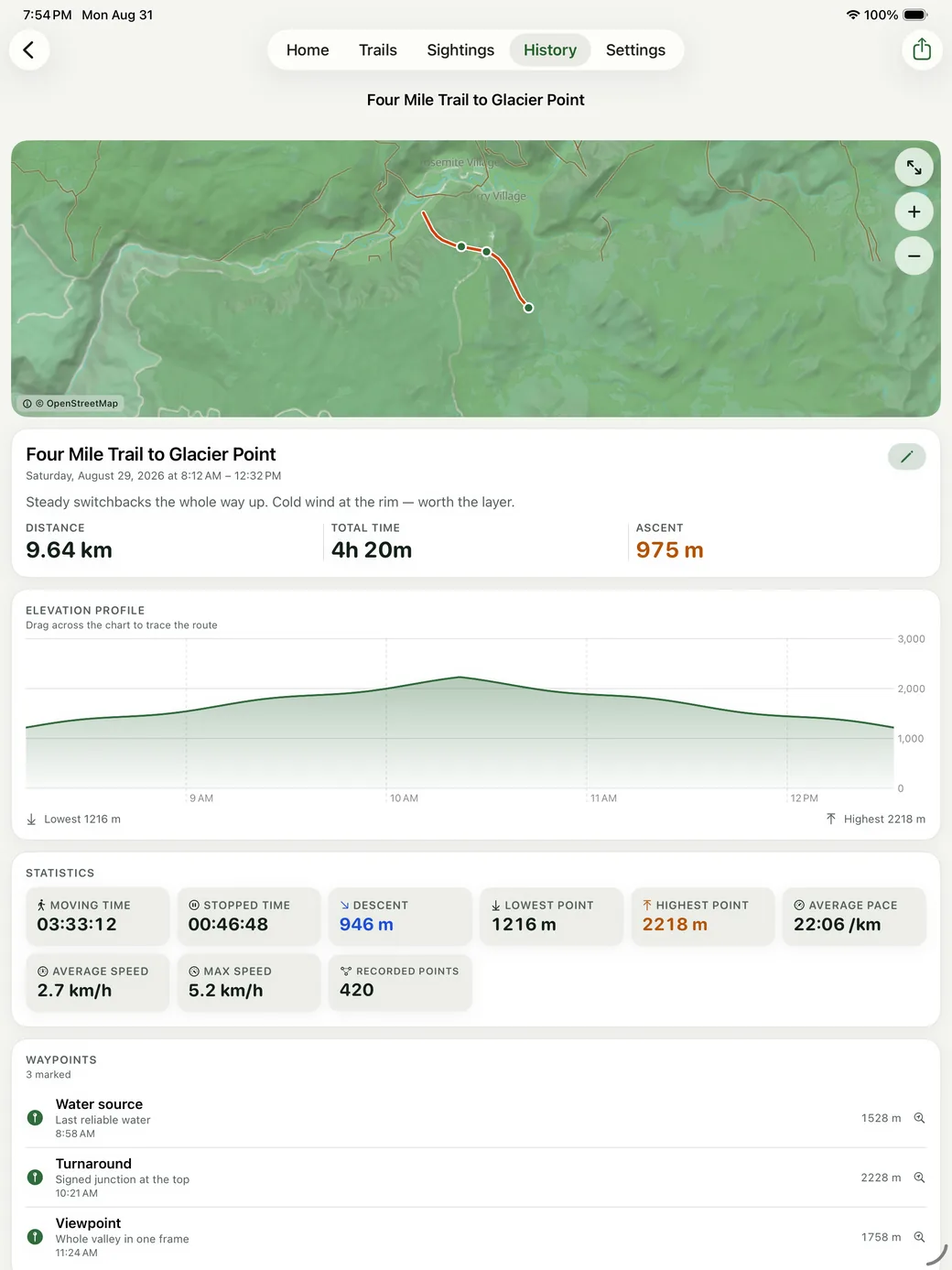
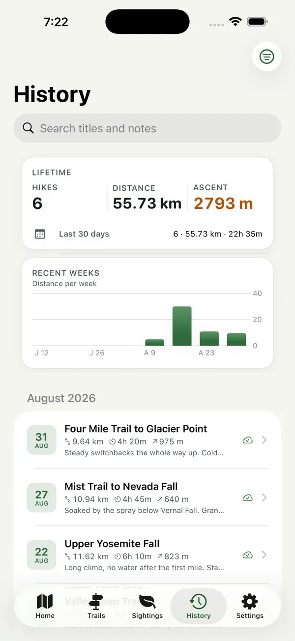
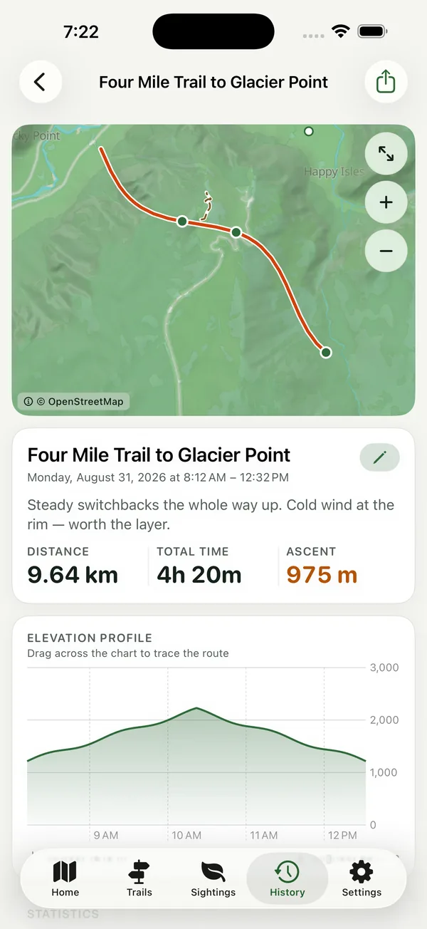
Every hike keeps its route, elevation profile, waypoints and statistics. Drag the profile and a marker traces the map. Name it, add notes, and export it as GPX with timestamps intact. History groups by month, with lifetime totals and a weekly distance chart.
Turn on iCloud and finished hikes sync through your own private database to your other devices. Leave it off and everything still works.
Apple Watch
On your wrist
Start a hike on the phone and HikeGPS opens on your Apple Watch by itself: distance, time and ascent in large figures, and the map, drawn on the phone with the same cartography and offline like everything else, with your route on it. Pause, resume, finish or drop a waypoint from the wrist, and watch your heart rate.
Every screen, in order
The same screenshots as the App Store listing. Scroll sideways.
Also included
- Live Activity and Dynamic IslandA timer on the Lock Screen that respects your pauses.
- WidgetsThe current hike, the last one, and the week's distance.
- BacktrackYour route in reverse, with the bearing to the trailhead.
- GPX in and outImport tracks as editable plans; export with timestamps and elevations intact.
- Accessible outdoors and inMetric and imperial, Dynamic Type, VoiceOver, dark mode.
- Seven languagesEnglish, German, Spanish, French, Japanese, and both Chinese scripts.
Private by default
No advertising. No account. No cross-app tracking. Your hikes are stored on your device, and the developer holds no copy of them. Turn on iCloud to sync finished hikes through your own private database, which only your Apple Account can read; leave it off and it all still works.
The one network request the app makes is for map tiles, from servers run for HikeGPS. Anonymous usage statistics record which screens are opened, never your routes, photographs or sightings. The privacy policy spells out exactly what is kept and for how long.
A navigation aid, not emergency equipment
Phones run out of battery, lose GPS accuracy under cliffs and canopy, and cannot call for help without signal. HikeGPS provides no turn-by-turn routing and no SOS capability. Carry a map, a compass, and a way to summon assistance, and tell someone where you are going.
Take the map with you
Free on the App Store for iPhone and iPad, with a companion app for Apple Watch.

Map data
Map data is © OpenStreetMap contributors, available under the Open Database Licence. Basemap tiles are built from Protomaps and served from infrastructure operated for this app. Terrain shading uses open elevation data. HikeGPS never bulk-downloads from OpenStreetMap community tile servers, whose terms prohibit prefetching.